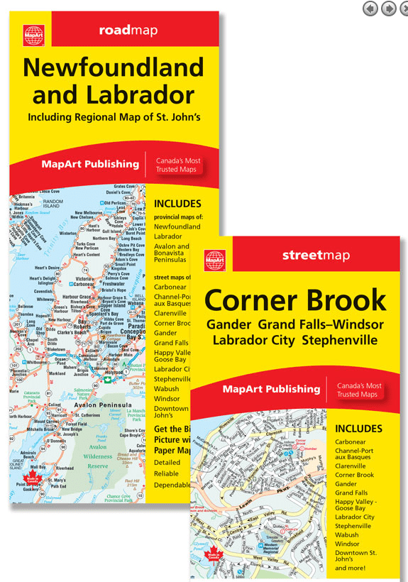
The folded map of Newfoundland and Labrador /Cornerbrook includes provincial maps of Newfoundland (1:984,500) and Labrador (1:3,000,000), an inset map of Avalon and Bonavista peninsulas (1:550,000) and community index. Detailed city maps at 1:25,000 of Carbonear, Channel - Port aux Basques, Clarenville, Corner Brook, Gander, Happy Valley - Goose Bay, Labrador City / Wabush, Stephenville, Windsor and their corresponding street indexes is also included. Other features are a detailed downtown St. John's map at 1:15,000, ferry information and an Atlantic Canada distance chart.
The detailed city mapping features include divided highways, major roads, secondary roads, main thoroughfares, minor streets, lanes / private streets, interchange numbers, one way streets, Trans-Canada Highway, railways, ferries, municipal boundaries, parks / conservation areas, golf courses, commercial areas, cemeteries, institutional areas, industrial areas, hospitals, tourist information centres, police stations, fire halls, municipal / regional buildings, courthouses, libraries, points of interest, liquor stores, marinas / yacht clubs, national parks / historic sites, arenas, pools, baseball, soccer, tennis, cross-country skiing, campgrounds, public schools.
The regional map features include Trans-Canada highway , expressways, main highways, paved regional / major roads, loose surface regional / major roads, paved and gravel s, unimproved roads, distance between two points, ferries, fishing stations, populations, capitals, provincial boundaries, time zones, trails, national parks / historic sites, provincial parks, wilderness reserves, spot elevations, travel information centres, hospitals, points of interest, airports, campgrounds and skiing.